Overview
The rapid development of the internet of things (IoT), sensing technologies, Artificial Intelligence (AI), machine learning, and deep learning techniques have yielded new perspectives on how novel technologies can be applied to smart cities. The New York City IoT Strategy Report 1 highlighted that the city has been home to a major expansion in IoT and AI use in the last decade, with impacts on many areas, including its transportation system.
As a subfield of AI, computer vision is showing promising potential in understanding the realistic dynamics of cities. While cities are complex by nature, especially cities like NYC, the applications of computer vision show progress in tackling a variety of complex physical and non-physical visual tasks. For example, the use of computer vision can align with the city’s Vison Zero goals for traffic safety. In addition, computer vision can turn existing infrastructure into smart sensors in a myriad of ways, and new applications are being continuously developed. Agencies including NYC Department of Transportation (NYC DOT), NYC Department of Design and Construction (NYC DDC), and NYC Mayor’s Office of the Chief Technology Officer (CTO) have identified a “wishlist” of area of interests in using computer vision technologies for the city.
The wishlist includes using computer vision tools to validate the accuracy of collected mobility data (e.g., turning movement counts, vehicle classifications, vehicle and pedestrian speed, etc.), parking utilization, work zone assessment, incident detection, mobility aid detection, vehicle-pedestrian conflicts, as well as assessing how the computer vision algorithm can be trained for NYC conditions where there may be difficult sightlines and blockages and restrictions on camera placement. This wishlist provides the foundation of understanding agency needs and what the technology can offer.
Research Objectives
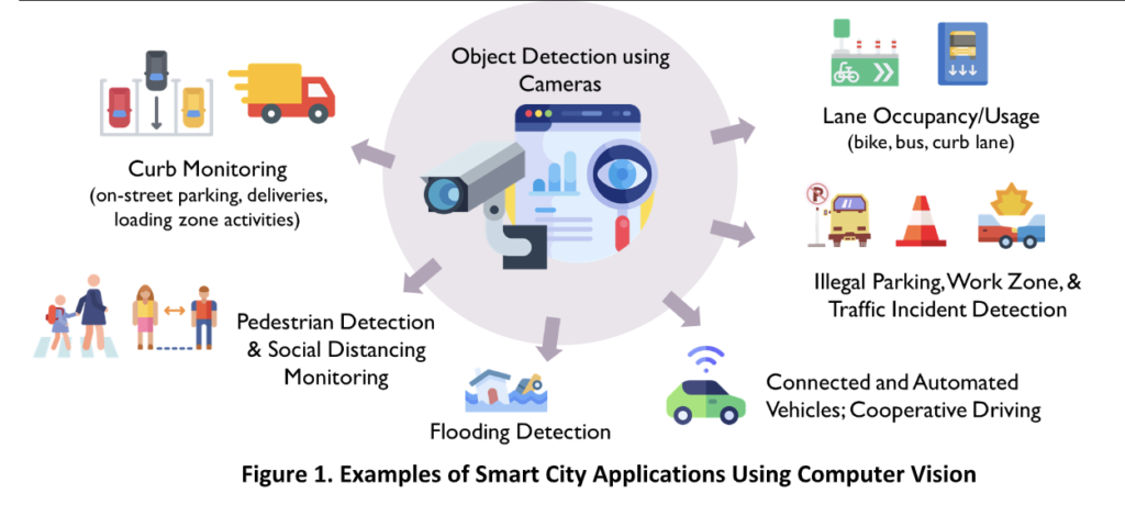
This project is focused on developing a deep learning based data acquisition and analytics tool using vision-based sensors (i.e., cameras) to understand cities with machine eyes. The team is assessing the maturity of various smart city applications using computer vision and object detection (e.g., pedestrian detection, work zone identification, curb lane usage, connected and automated vehicles (CAVs)) as well as the needs of local agencies. The goal is to demonstrate the cost-effectiveness of the computer vision technology to generate new stream of mobility data and provide support for planning and operational strategies, utilizing both existing transportation infrastructure and emerging probe and CAVs.
More specifically, this project aims to establish an inventory of available traffic camera systems in the US and deploy two computer vision smart city applications based on stakeholder feedback that are customized for NYC. The team is also establishing a formalized pipeline for running the computer vision algorithms enhanced for NYC conditions and prototyping the applications for real-world implementation.
Related Media

Advisory Board
Paul Rothman
Director of Smart Cities + IoT, Strategic Initiatives, NYC Office of Technology and Innovation
Asheque Rahman
Senior Traffic Engineer, Design, Infrastructure, NYC Department of Design and Construction
Howard Jiang
Engineer in Charge, Construction Management Unit within Infrastructure Division, NYC Department of Design and Construction
Seth Berman
Senior Transportation Planner, Transportation Planning and Management Division, New York City Department of Transportation
Justin Romeo
Director of Special Project, Regional & Strategic Planning, New York City Department of Transportation
Rob Viola
Director of Safety Policy & Research, New York City Department of Transportation
Zamir Alam
Deputy Director, Modeling and Data Analysis, New York City Department of Transportation
Dan Wan
Data Scientist, Modeling and Data Analysis, New York City Department of Transportation
Ruoran Lin
Transportation Planner, Transportation Policy and Analytics Division, New York City Department of Planning
Maddalena Romano
Director of the Data/Asset Management Unit at New York City Department of Transportation


