Overview
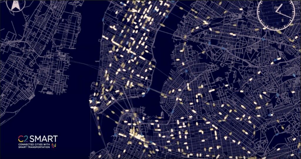
As cities grow and new transportation alternatives and technologies emerge, the complexity of managing urban transportation systems increases as well. Transportation policymakers and agency leaders need models that can support time-sensitive planning, operation control and policy implementation. C2SMART is working to fill this need through the development of an open-source, large-scale microscopic transportation model that covers the entire New York City area and integrates data and modeling capabilities for new technologies such as connected and autonomous vehicles, electric vehicles, dockless bikes, and ridesharing systems.
In previous years, the research team has developed and calibrated a base model implemented in MATSim and SUMO. This virtual testbed simulates an 8-million-person population and includes cars, trains, bus, bikeshare, taxi, and other for-hire vehicles calibrated to the year 2016. The team is building the architecture to host this virtual test bed and developing system design and user guide documentation. In addition, the models are being applied to evaluate specific projects like the effects of connected vehicles on safety along a key corridor in downtown Brooklyn or to evaluate the effects of the planned congestion pricing policy and the use of carsharing fleets. In this phase of the project, the virtual testbed will be enhanced to incorporate more applications for emerging mobility services and the team will develop a web-based interface for the ecosystem. The research team will also seek to connect with and train potential users, such as policymakers and other researchers, to encourage adoption of the virtual testbed for real-world use and new research applications.
Research Objectives
COVID-19 Recovery and Congestion Pricing
The open-source, modular nature of the Multi-Agent Transport Simulation (MATSim) Virtual Testbed has allowed a team of researchers led by Dr. Joseph Chow and Yueshuai Brian He to add timely new simulation extensions: the impact of congestion pricing on transit behavior and MTA revenues, and the effects of the pandemic and an ensuing recovery on transit use.
A Pandemic Recovery Plan
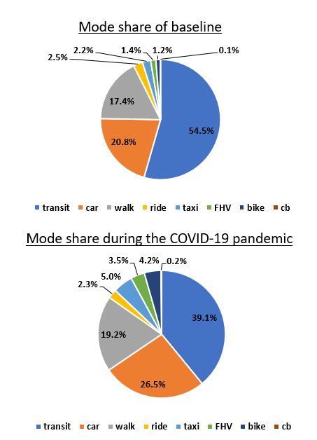
How will transit patterns change as New York City begins to reopen in stages? Researchers recalibrated the simulation testbed to evaluate the impact of COVID-19 on mass transit ridership, demonstrating how MATSIM might be used to help policy-makers plan for reopening.
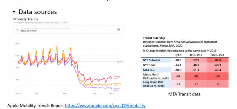
Using Apple Mobility Trends Reports, MTA Transit Data and NAICS industry codes, the research team recalibrated mode choice to fit updated ridership data and account for the shift to cars during the COVID-19 pandemic. The team will simulate a multi-stage recovery on the synthetic population by “reopening” manufacturing/construction industries while keeping schools and nonessential businesses close, mirroring governor Andrew Cuomo’s stated plan for reopening New York City.
Congestion Pricing
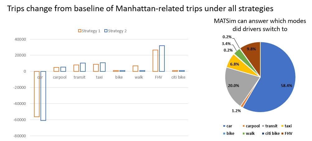
How will NYC’s plan to charge congestion pricing south of 60th Street relieve congestion in Manhattan and raise public transit funds? How much should drivers be charged? Researchers used MATSIM to evaluate two price schemes to see how each would affect traffic and mode-shift from between transportation forms, along with impacts on consumer surplus and MTA revenue.
Other Applications
Building on the development of the testbed in previous years, this project will further enhance its applicability and aim to transfer knowledge for using the testbed to local agencies and other members of the C2SMART consortium. The objectives for this phase include:
Application Enhancements
Researchers are working to develop direct extensions using the base model, such as automated and connected taxis and dockless bikeshare. Different deployment scenarios will be evaluated to provide decision support capabilities to transportation agencies, and a new integrated web-based data analytics toolbox will be developed to allow researchers to analyze extensive output of MATSim.
In future iterations, researchers will apply a modification of traffic flow model in MATSim to improve consistency with SUMO and connected vehicle technology in a new model instance, and test and implement multimodal travel capability using the R5 routing engine adopted by BEAM for a new model instance.
Technology Transfer
C2SMART will publish a web interface for the virtual testbed, open a beta testing period and invite participants from local agencies to evaluate and provide feedback, and host webinars to share lessons learned in procedures for developing MATSim models and integrating with SUMO with students and PIs at consortium member universities, which will support the expansion of the testbed to other cities.
Background
MATSim-NYC emerged from the desire to develop a large-scale, open-source, agent-based model. MATSim-NYC is an activity-based, extendable, multi-agent simulation framework implemented in Java, and calibrate it based on public sector data from the New York metropolitan area. These data include household travel survey and BPM update data from NYMTC, LION (Linear Integrated Ordered Network) GIS data from NYCDCP, TIMS (Traffic Information Management System) and the MIM (Midtown in Motion) real time data from NYCDOT, and transit schedules from GTFS (General Transit Feed Specification) data from MTA NYCT (Metropolitan Transportation Authority New York City Transit). The researchers will also incorporate other emerging data sources like NYC TLC taxi data, social media data from different sources and other emerging partner companies that collect probe vehicle data at an unprecedented rate.
This data-driven approach to validate and calibrate the proposed agent-based model will be one of the first attempts to develop a highly dynamic simulation tool that incorporates big data into microscopic simulation.
In addition, the research team selected one sub-area in lower Manhattan and downtown Brooklyn to develop using an open-source microscopic traffic simulation framework (i.e., SUMO (Simulation of Urban MObility). SUMO allows microscopic modeling of intermodal traffic systems including road vehicles, public transport and pedestrians.
Related Media
