Overview
Of the myriad impacts that are predicted to accompany climate change, flooding is expected to have an outsized influence on public health, infrastructure, and mobility in urban areas. In New York City, for example, sea-level rise and an increase in the occurrence of high-intensity rainstorms have led to a dramatic increase in flood risk, particularly in low-lying and coastal neighborhoods. The physical presence of standing water on streets and sidewalks can impede mobility and restrict access to transportation. Additionally, urban floodwater contains a diverse array of contaminants, including industrial and household chemicals, fuels, and sewage., Access to real-time information on flooding can improve resiliency and efficiency by allowing residents to identify navigable transportation routes and make informed decisions to avoid exposure to floodwater contaminants. However, very little data exist on the frequency and extent of urban surface flooding, and there is an unmet need for hyperlocal information on the presence and depth of street-level floodwater. This unmet need for data from urban floods motivated the development of the FloodSense project in early 2020, with the objective of developing a platform to provide real-time, street-level flood information – including the presence, frequency, and severity of local surface flood events – to a range of stakeholders, including policymakers, government agencies, citizens, emergency response teams, community advocacy groups, and researchers.
The FloodSense project began in 2020 with funding from the C2SMART Transportation Research Center, with overarching goals to (1) design, build, deploy, and assess robust, low-cost sensors in diverse urban environments to track street-level flood occurrence and depth, and ultimately, (2) to implement an interface to communicate the data to a range of stakeholders. Specific tasks were the following:
- Task 1- Sensor solution discovery and evaluation (including evaluation of sensor, power, connectivity, and data storage and delivery solutions)
- Task 2 – Prototype deployment, assessment, and initial data collection
- Task 3 – Development of an online interface for data communication
Research Objectives
Based on our experience conducting the work described above, and conversations with various stakeholders, we have identified three objectives required for larger-scale deployment of a flood sensor network that provides actionable data for improved mobility and resiliency across stakeholder categories:
Objective 1 – Expand the ultrasonic flood sensor network
Given our successful pilot sensor deployment, we plan to expand the number of ultrasonic flood sensors in the network. The deployment locations will be decided in consultation with NYC agencies and community partners, in an effort to fulfill a range of data needs.
Objective 2 – Develop a public-facing data dashboard to transfer flood data to a range of stakeholders
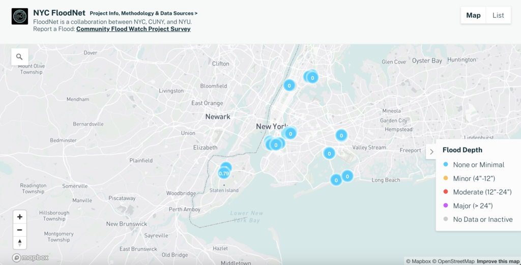
The outcome of this objective will be an easily accessible, public-facing online portal that provides flood sensor data in a manner that meets the needs of various stakeholders, and incorporates additional data streams such as community reported flood events, rainfall levels, 311 flooding complaints, and social media feeds.
Objective 3 – Evaluate the feasibility of new flood sensor modalities
The current sensor configuration involves mounting the unit on a U-post, which limits flood detection to water levels that rise over the curb cut and onto the sidewalk (i.e., floods must be greater than approximately 7 inches in depth). This is because the ultrasonic sensor can only measure water level directly underneath the sensor, and U-posts are always installed on sidewalks. While this remains important information, additional sensor modalities are required to measure floods that are confined to roadways. We plan to evaluate the feasibility of additional sensor types that can either utilize different urban infrastructure for sensor deployment (e.g., sewer grates in the roadway), or alternate sensor technologies (e.g., cameras employing edge computer-vision) to measure flood extent more remotely.


